Original article by Dale (and other of his adventures) here.
Day 0. Walking the El Camino de Costa Rica
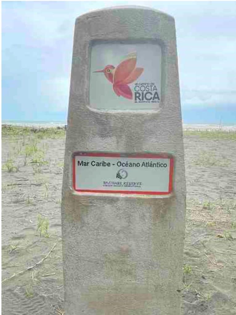
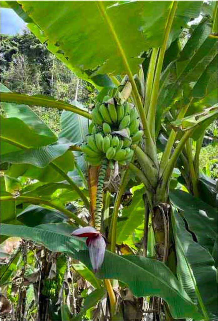
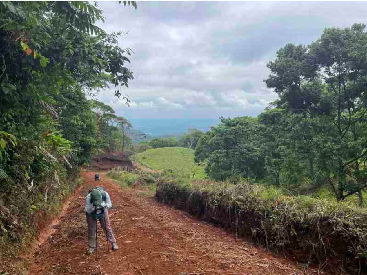
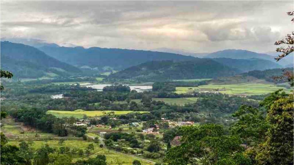
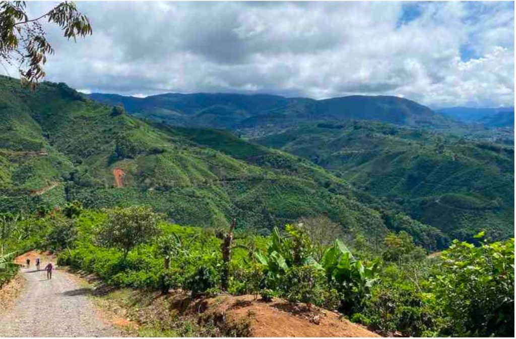
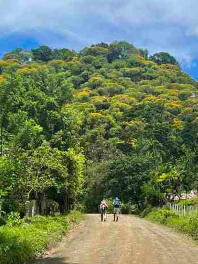
El Camino de Costa Rica is a 280 km (170 mile) walking route through Costa Rica, beginning on the Atlantic side and running all the way to the Pacific. The trail begins just south of the Tortuguero National Park, where the Pacuare River empties into the Caribbean, and it runs its way through banana and pineapple plantations of the lowlands, up into the mountains with rainforests and coffee plantations, and down through the valleys and rural communities of the interior, before ending in the Pacific coastal town of Quepos.
I learned about this trip thanks to the Active Travel Adventures podcast hosted by Kit Parks. I joined her and 9 other people from the US and Canada on a 15-day walk (plus two rest days) in mid-April organized by UrriTrek. This should not be your first long-distance walk! If you have hiked the Camino de Santiago in Spain, and the idea of crossing an entire continent appeals to you, then perhaps you are up to the challenge of this Camino. Like the Camino de Santiago, you are going to pass through rural villages, agricultural areas, and forests, and you will be walking on a mix of dirt or paved roads, plus forest trails. El Camino de Costa Rica is wilder; this is one of its great attractions. During the 16 different stages, you will be passing through at least 5 distinct ecosystems. The diversity of flora and fauna you will see is jaw-dropping. El Camino de Costa Rica is also harder. While the highest point (continental divide) is only 2035 m (6700 ft), you are going to do a lot of ups and downs. It is estimated that the total elevation gain and loss is 5800 m (19,000 ft) with grades as much as 25%. River crossings, rain, mud, bugs, heat, and humidity all add a little extra something that you need to be prepared for.
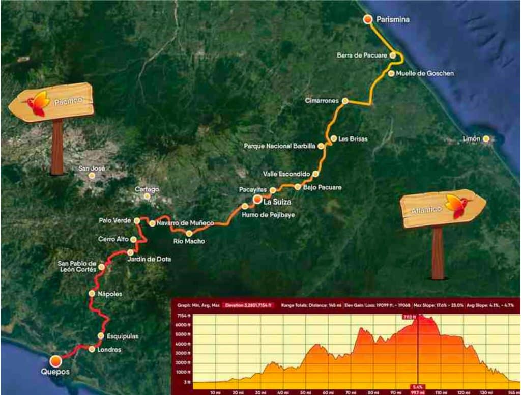
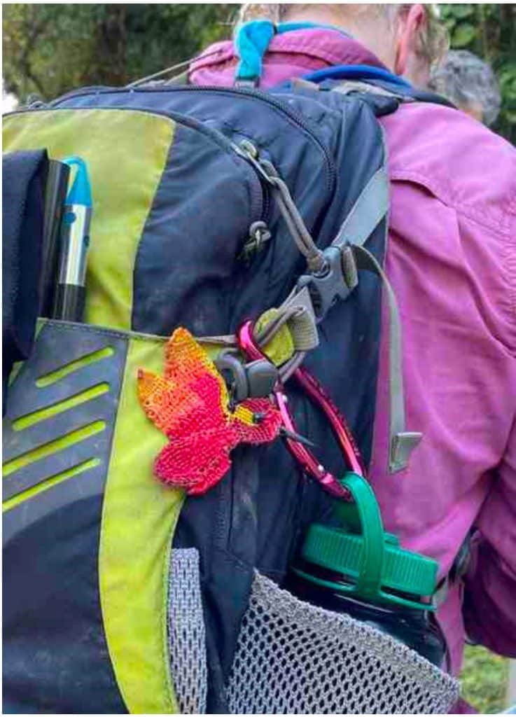
There are other differences too. El Camino de Costa Rica is a relatively new trail. It does not have the 1000+ year pilgrimage history of the Camino de Santiago and thus fewer people have walked it end to end. As of 2022, only 500 people have completed the trail – about ten times more people than that have summited Mt Everest! The Costa Rica Camino is not as well marked as Camino de Santiago. The red/white slashes or hummingbird trail markers on trees and poles are rare or hard to find. A guide or good GPS app is needed; you can’t walk on the indigenous land without a guide. El Camino de Costa Rica will help you find a guide for a trip. And finally, self-organized tours are more difficult as you’ll need to do more work to find places to eat and sleep. Often the restaurants were small enough that the guide needed to call ahead a day or two in advance. Failing that, all that you have are small stores along the way.
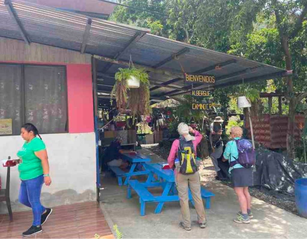
Day 1. Tuesday, April 12. Meet and Greet at Mile Zero
Distance = 7km (4.2 miles)
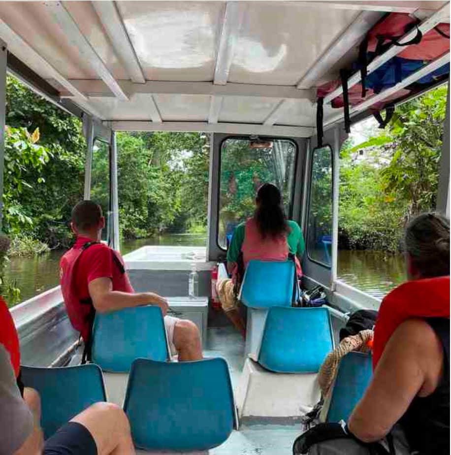
Four of us were picked up at our hotel in San José by Juancho, our UrriTrek guide, and we made the 3-hour drive to Goshen dock. There are no roads beyond this point, so we traveled down the heavily forested Madre de Dios River canals in a boat. Even on this brief ride, there was a lot of wildlife to see and hear, including howler monkeys, herons, a family of bats sleeping in a straight line on a tree, and a large crocodile.
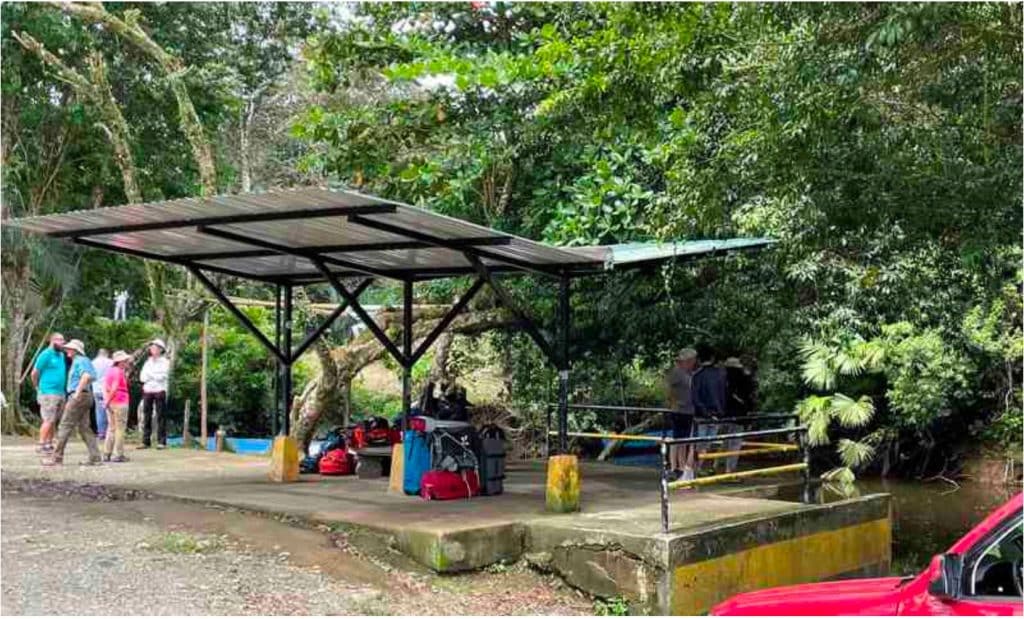
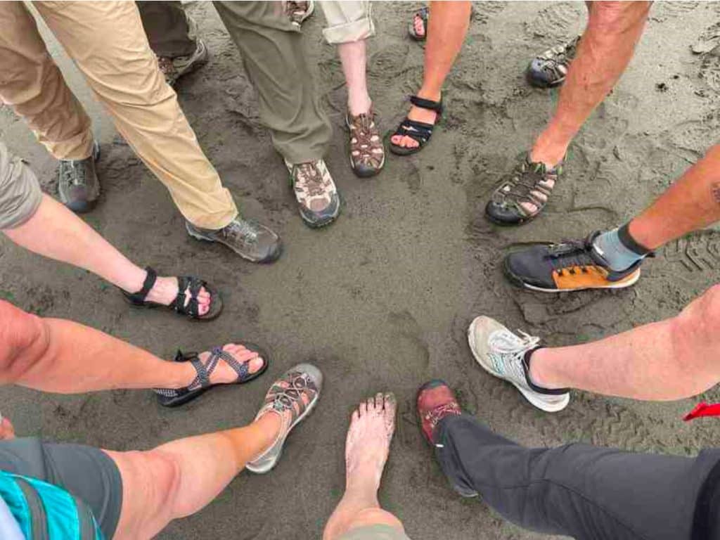
We docked at Lirio Lodge where we met the rest of the hiking group who had arrived earlier. After lunch, we boated across the lagoon to the Pacuare Reserve and Mile 0 of El Camino de Costa Rica. We all stuck our feet into the water of the Atlantic to celebrate the start of our adventure and then we walked down to the beach taking in all the wildlife that lives in the area where the sea meets the jungle.
Before dinner, we had a happy hour where we drank some wine and shared stories about ourselves and our past travel. This is going to be a great group to walk the Camino with. Three men and eight women who come from all over the US (Iowa, Idaho, Arizona, New Mexico, California, Virginia, New York, and Tennessee) and Canada (Ontario). We range in age from 50 to the mid-70s, with most 60-ish. We are all very experienced hikers and have the right attitude and humor to take on whatever comes. After dinner, I went to bed early, while the others returned to the beach to hunt for sea turtles coming in to nest. Some tracks were seen, but alas, no turtles.
Day 2: Wednesday April 13. The Caribbean Lowlands (Goshen Dock to Cimarrones)
Distance = 25km (15miles)
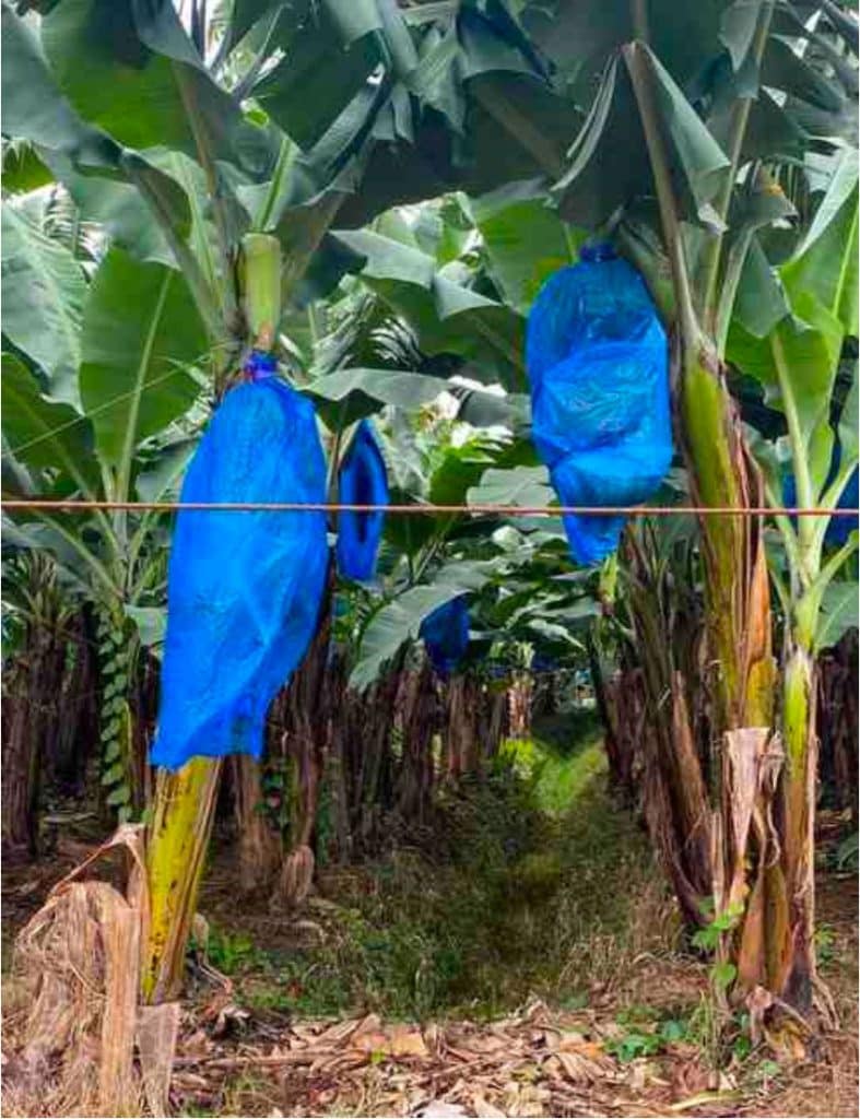
We woke up to a cloudy sky and light rain and boarded a boat back to Goshen dock. The weather was a godsend since we would be in the Caribbean lowlands all day with no shelter from the sun. We walked mostly on dirt roads with miles and miles of banana plantations that gave way to pineapple fields later in the day.
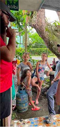
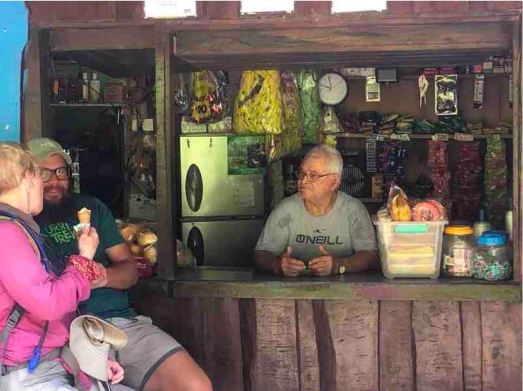
There were a few paved roads near the small villages we passed through. We stopped at a tiny store in one village and swarmed the place for ice cream and other treats. Three little girls looked at us wide-eyed with our ponchos, hiking poles, sun hats and day packs, as if some zoo animals had wandered into their town.
Partway through the day we had a fruit break and then a late lunch in a private home. It was a wonderful Caribbean-style meal; chicken, coconut rice and beans, plantains, beets, potatoes, carrots and more. No one is going to starve on this trip! After lunch we rode a car along Route 32 for a short distance to Coast-to-Coast Glamping where I had a welcome cold shower, washed my clothes and ate dinner. After learning the basics of Gin Rummy and playing a few hands, I followed firefly light back to my tent for the night.
Day 3. Thursday April 14. Breakfast and a Hill (Cimarrones to Las Brisas)
Distance = 19km (11.4 miles)
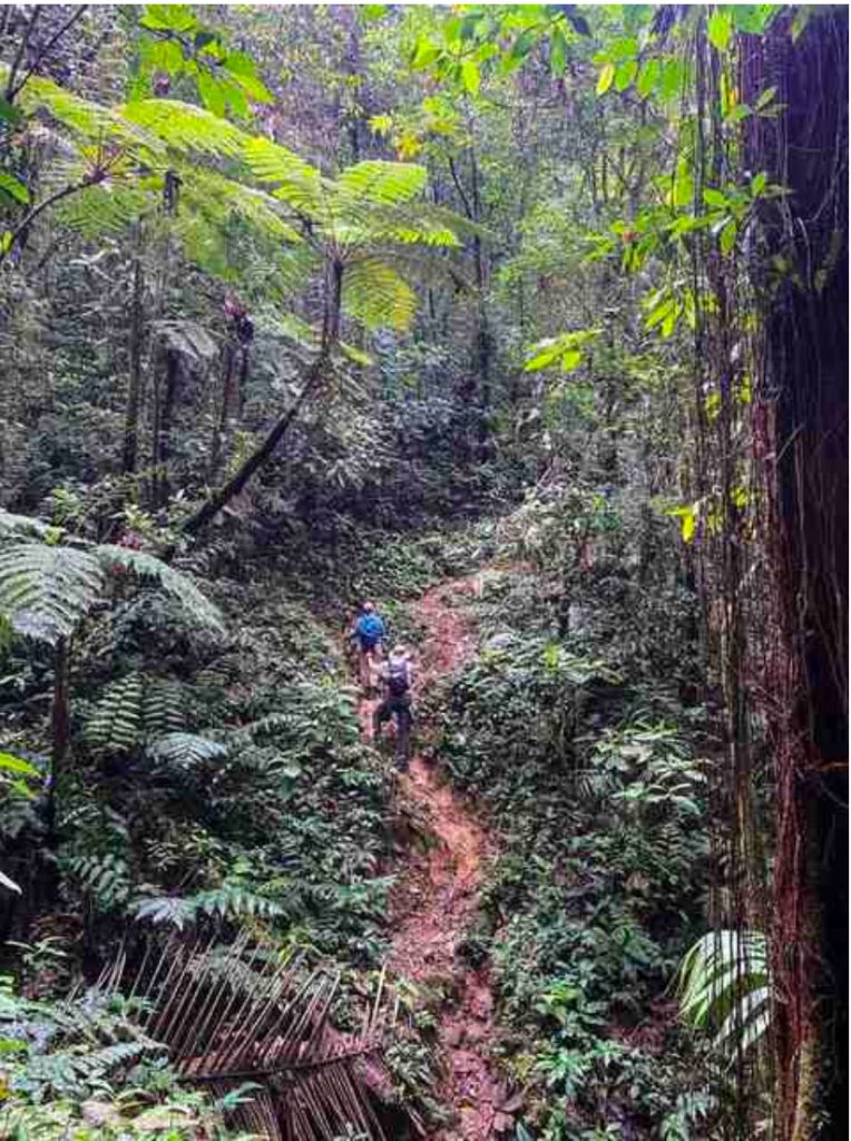
After breakfast we were dropped back off at the trailhead near Cimarrones. Thus began a familiar daily pattern on this Camino – walking up steep hills first thing in the morning. It was a hard slog and there was a lot of grumbling. Nonetheless, it was better to do the hills when our legs were still fresh. This is also the point in any walk that any blisters appear, and I had a few small ones. The views of the Caribbean looking backward from which we had come the previous day made the pain all worth it. Our second guide, Geovanni, gave us a nice treat at the top opening up guaba bean pods and letting us try the fleshy fruit with its sweet vanilla taste.
At some point later in the morning we entered the Pacuare River Forest Reserve where the trail narrowed and the jungle closed in. We stopped in the jungle to eat our lunch of a large cheese tamale wrapped in a banana leaf and we pushed on to a road where we walked the final few kilometers downhill to Marine House, a private home where we would eat a buffet-style dinner and spend the night.
Day 4. Friday April 15th. Ancient Peoples and Dense Tropical Forest
Distance = 20km (12miles)
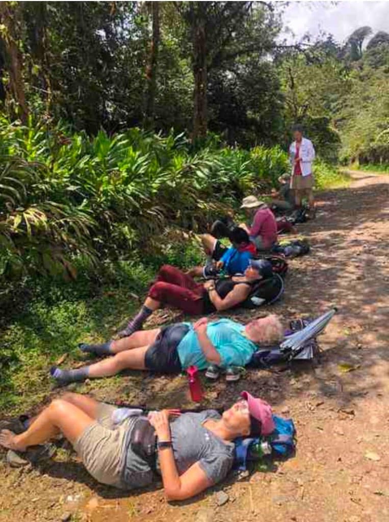
This was a long, hard day that nearly broke some of us. We had a 5 am start and ate our breakfast sitting on the balcony overlooking the jungle canopy with wisps of clouds glued here and there, and the sounds of howler monkeys welcoming the sunrise. Only 6 of us went on the walk today. The others stayed behind to rest and tend to blisters. After a pleasant morning at Marine House, they were driven with our luggage to the hotel. We, on the other hand, made the trudge back up the hill (breakfast-and-a-hill) to the trailhead where we met our indigenous guide.
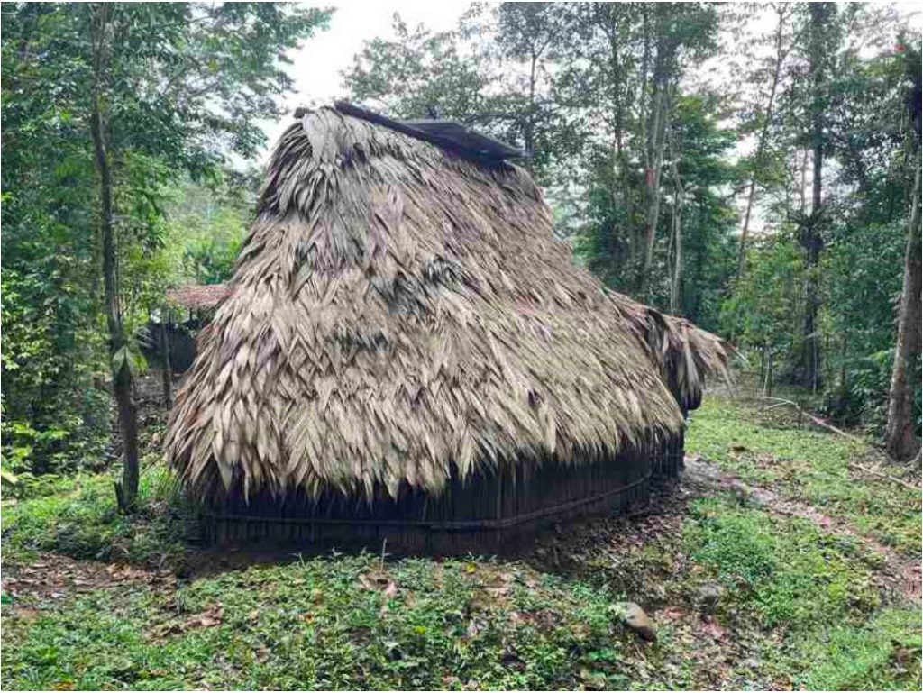
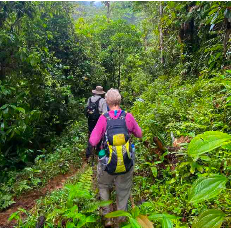
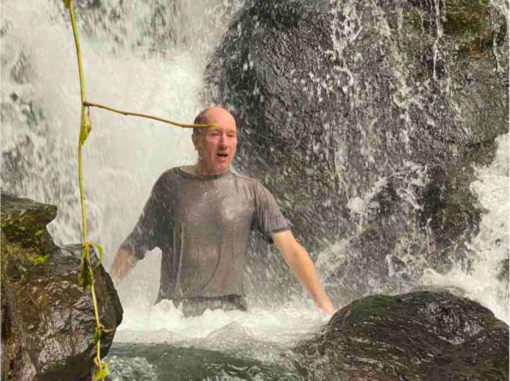
Today we passed through the ancestral homelands of the Cabécar people. The walking was difficult. It was a muddy, steep track through dense jungle with several river crossings. If I was given the chance, I would walk this section of the trail again. I spent so much of my time looking at my feet, trying not to slip and fall, that I rarely got to take in all the natural beauty around me. We stopped to have a late lunch where we got a tour of traditional Cabécar houses and viewed some displays, including a description of their cosmography.
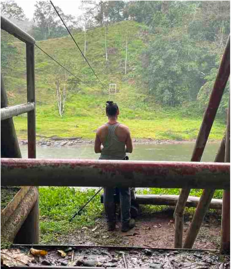
As if to cap off the whole day, when we finally arrived tired and wet at the Pacuare River, the 2- person basket meant to carry us across the river was stuck. So now we had to hold on to a rope and wade waist-deep through the rapids across the river, and then walk up a 1.5 km hill to the van that took us to the Pacuare Mountain Adventure Lodge a short drive away. When we arrived (11 hrs after the start of the walk), our rested hikers handed us each beer or wine – god I love these people! I then had a hot shower, a 7 pm dinner and went to bed early.
Day 5. Saturday April 16. The Pros and Cons of Guided Adventure Tours
Distance = 0km (Zero day)
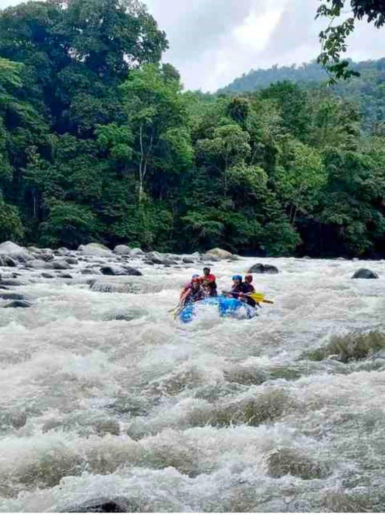
Rather than walk the Camino today, we drove back to the Pacuare River. It is listed as one of the top rivers in the world for whitewater rafting day trips. Along 30 km on the river, we paddled through some Class II, III and IV rapids, floated in the water during the slow bits, and saw many bird species in the surrounding pristine rain forest. The others enjoyed the river more than I did, but it was still fun. For lunch we went on shore, walked up a steep hill to an eco-lodge, where we relaxed in Adirondack chairs looking down on a bend in the river. It was one of those pure moments in life that you never want to end.
This is my first time going on a long-distance walk with a guided adventure tour company. I can see some real benefits and some limited downsides.
Pros of going with a guided adventure tour company:
- The tour company is going to take care of a lot of piddling details. It is really relaxing to know that all that you have to do is get up and walk and take whatever comes each day. Our itinerary unfolded like magic. When we needed one, a driver was there at the trailhead to take us back to our hotel. Our rooms were ready, our luggage was always waiting for us when we arrived, and any item we left behind by mistake in the morning was there for us at the new hotel in the evening.
- You knew where you were going to sleep every night, guaranteed. While on the Camino de Santiago I found it freeing to walk as long as I wanted and then check into a random albergue at the end of the day. However, you also had to be prepared to walk another 6 km if an albergue was full.
- You’ll find your tribe. These trips can be self-selecting. You’ll be walking with people who love adventure travel as much as you do. Unlike your friends and relatives who listen politely to your stories, these are people who can match you and inspire you to do more.
- Local knowledge is invaluable. I think this is really, really important for less visited areas of the world, where there may be less information online and there may be language barriers. Restaurants and hotels on the Camino de Costa Rica were the best example of this. We ate excellent regional cuisine for lunch at places that I would never have noticed on my own or given a second look. The web doesn’t know some of these places even exist.
- In the same vein, guides for a group tour also add a lot of value for relatively low cost. I brought bird and plant books with me but without Juancho’s wealth of knowledge and passion for the natural history of Costa Rica, I would have been lost. Identifying Costa Rica’s flora and fauna is like drinking from a fire-hose with a straw. With our guides, we were also able to go off the standard route, taking more scenic and less traveled detours to the same destination.
- Get out of your comfort zone. It takes an effort when traveling on your own to try new things and not fall back onto old patterns. I love the daily routine of long-distance walking trips. It is very soothing. I’m not going to do whitewater rafting, visit a spa, do yoga, take salsa lessons, or do a hydrangea or butterfly farm tour on my own. A tour company itinerary encourages you to just say yes to these new experiences and grow a little.
Cons of going with a guided adventure tour company:
- Walk your own Camino? Your pace of travel is set by the average member of the group. Maybe you are one of those people who like to stop at a church or stream to pause and reflect. Maybe you like to power up those hills. Fast or slow, you are going to have to keep the needs of the rest of the group in mind.
- Introverts unite, separately! I like to spend long periods of time in my own head. It can be exhausting to spend this much time constantly with interesting and energetic people. The solution is to schedule some alone time to recharge those “social batteries,” or find another introvert to walk next to silently.
- Your tribe may be hostile. While it did not happen on this particular trip, if there is one person who is not prepared for the physical challenge, or is not happy with the food, accommodation, etc., they can bring the mood down of the entire group. We all have stories of people who radiate unhappiness.
- I suspect that the maximum size group that these adventure tours work for is around 11-13 people. More than that, small cliques may form with less interaction overall.
Day 6. Easter Sunday. April 17th
“It’s not a town unless it has a church,l a football field and a school.”
Distance = 25km (15miles)
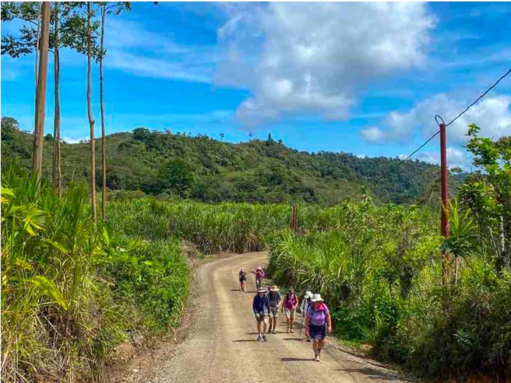
After breakfast, we were driven to the trailhead and started with a short tutorial on traditional methods for making chocolate. Yummy. I really enjoyed today. It reminded me of the Camino de Santiago with its mix of dirt roads and pavement, and passing through rural countryside and small towns. Partway along we stopped in a small grocery store in Pacayitas and bought more ice cream and other treats. Juancho says that the way you can tell you are in a town in Costa Rica is whether it has a church, a football field and a school. I liked the Pacayitas area with its Tropical Victorian homes, people watching a football game, and going about their everyday daily lives.
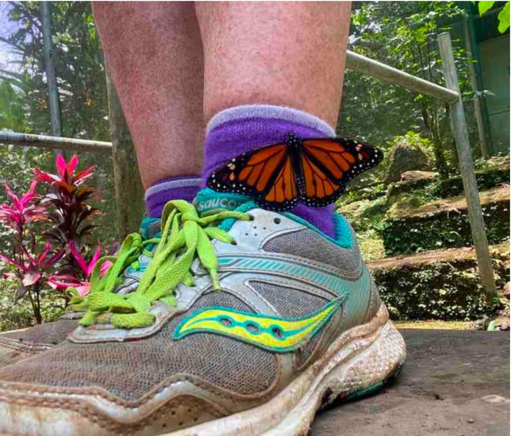
After the ice cream break, we stopped off at an archeological site and a butterfly farm. Over the next 3 km we climbed 300 m in the hot sun then stopped for a bag lunch at the top: a corn tortilla with papaya, fried plantain, chicken, beans and red pepper wrapped in a banana leaf. Most of the rest of the afternoon was downhill into the lake district communities of Canadá and La Suiza and across the Rio Tuis to Hotel Casa Turire a colonial deco-style boutique hotel and the fanciest place we stayed on our trip.
This had been a hard afternoon for most of us. Some retreated to their rooms to clean up and rest while others went straight to the pool and hot tub ordering beer and wine. I was fine. On any long-distance hike there comes a day when you get your hiker’s legs, when the pain and tiredness fades and you start feeling the energy and strength that comes with walking every day. Dinner was fancy. We might have been a little loud. I think we were all in bed by 8 pm.
Day 7. Monday April 18th. Costa Rica Flat (La Suisa to Pejibaye)
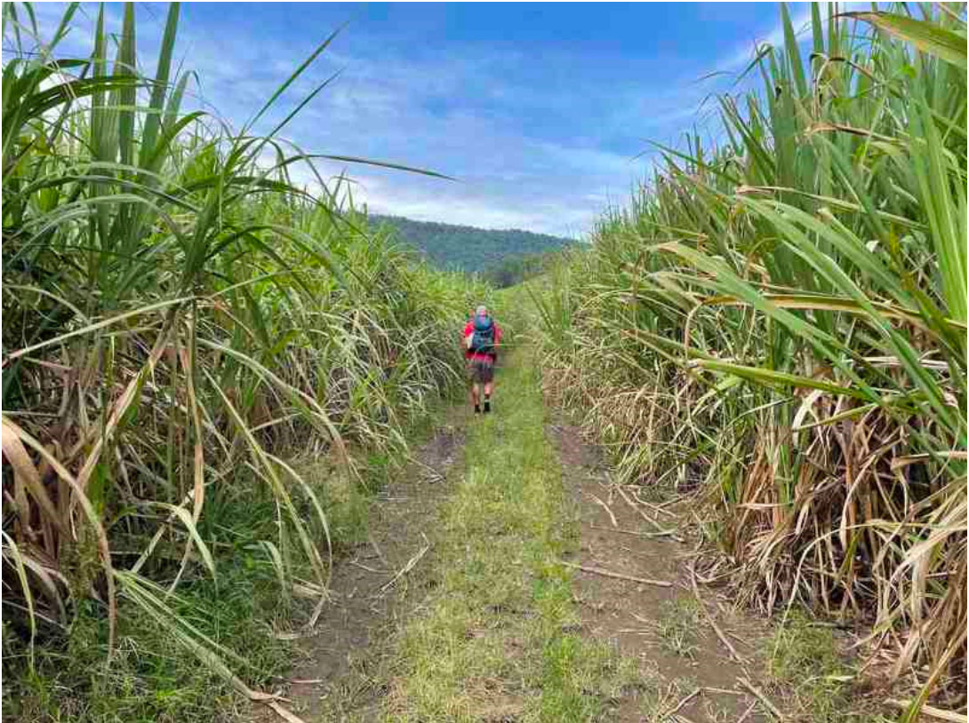
Distance=24 km (14.4 miles)
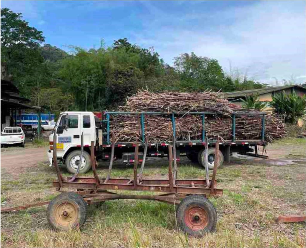
We started out walking along a busy road. There seemed to be two yapping little dogs in every house we walked by. Juancho and Geovanni took us on a detour through sugar cane fields, giving us a little shade from the hot sun. The previous day Geovanni pulled out his machete and we got to suck on some raw sugar cane. We passed by a sugar cane factory station and saw workers protesting its shutdown. We also walked by a giant Ceiba tree, thought to be sacred by the early people of Central America. For lunch we stopped at a café. It was a tiny jewel: a shaded shelter along the Pejibaye (peh-he-bah-he) River where we went to soak our tired feet and cool down before eating.

After lunch we walked to the town of Pejibaye where about half the group decided to take a taxi to our final stop. We bought a dozen beers for everyone later and sent it ahead in the taxi. The final few hours of walking were along paved and dirt roads to the cooperatively-owned El Copal Reserve. Juancho described the walk on days like this as “Costa Rica flat”. Apart from the occasional river valley, there are no flat sections in the interior of Costa Rica. They are not gentle rolling hills, nor are they steep hills that get your heart rate way up. Up and down. Up and down. Among our group, “Costa Rica flat” became a sort of curse word, muttered under one’s breath.
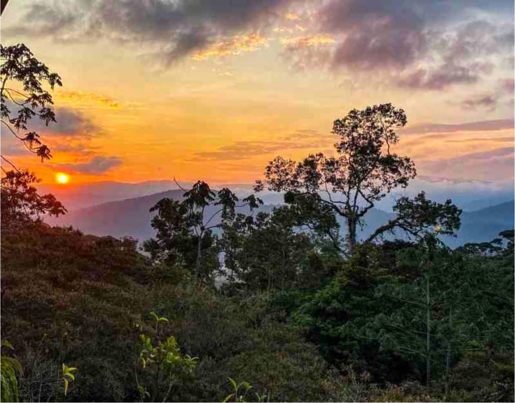
We cleaned up, ate and rested the night within the bird sanctuary known for its rare birds like the white-capped hummingbird. We had our cold beer, and watched an amazing sunset from the balcony. However, once the generator stopped for the night, we were in bed shortly after.
Day 8. Tuesday April 19. Lunch at the Halfway House (Pejibaye to Rio Macho)
Distance=20km (12miles)
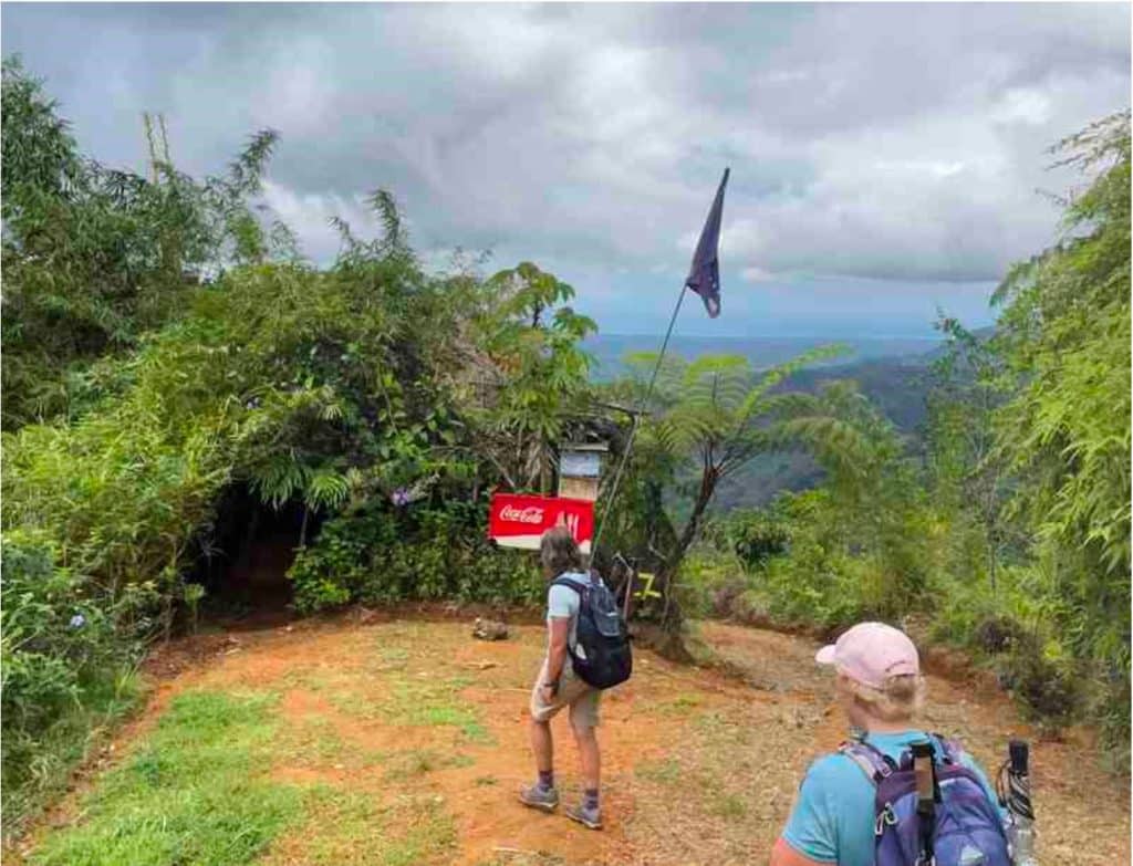
We started the day with a 7-8 km (5 mile) uphill walk! There must have been some downhill bits, but it all felt up to me. We were skirting the edge of the Tapantí-Cerro de la Muerte Massif National Park, walking on a jeep trail with several small river crossings and great views of the jungle below. We arrived at the top a few hours later, pretty exhausted. We are crossing the Talamanka range, and when the weather is good like it was today, you can see the Turrialba and Irazu volcanoes.
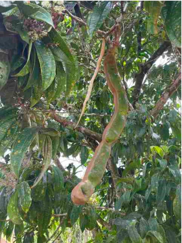
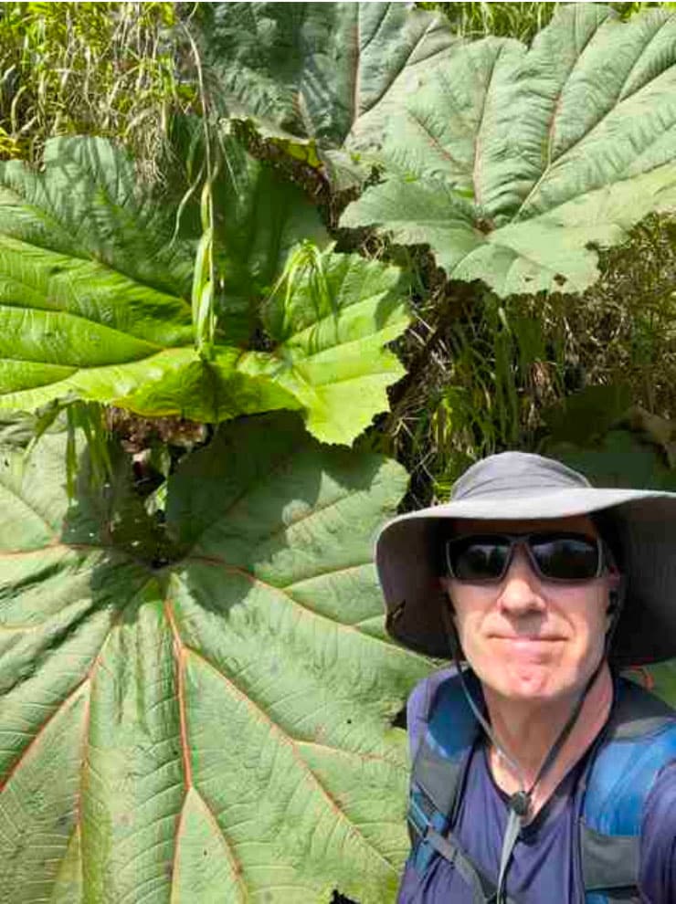
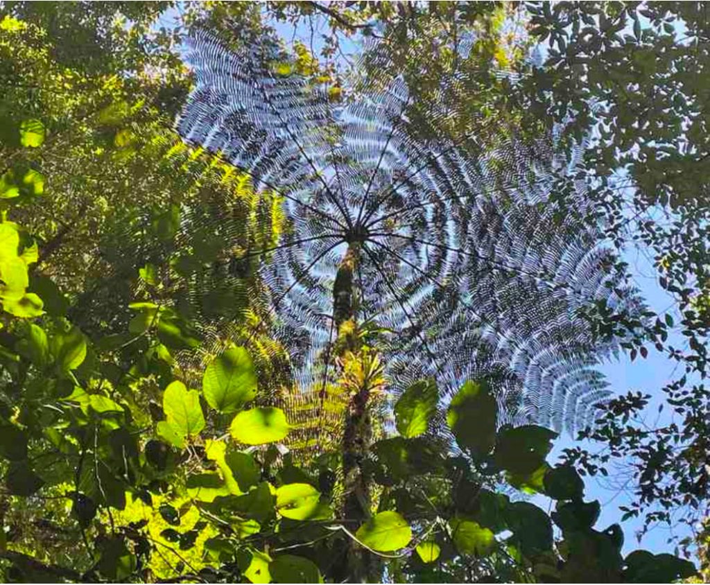
The ferns and other plants in the last few days have been really interesting. The helecho macho (Dryopteris) that looks like a house plant but whose leaves are 6 feet long. The leaves of the poor Man’s Umbrella (Gunnera insignis) seem way too large for evolution to have favored them, and the symmetric Tree Fern (Cyatheaceae family) is so ancient that it existed before the dinosaurs!
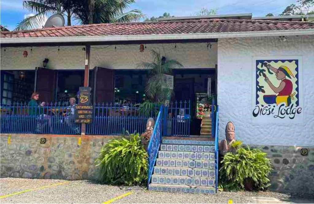
From the top we walked down into the Orosi river valley. We had lunch at the Albergue Camino Costa Rica, a family- run guest house and restaurant that marks the official half-way point of the Camino de Costa Rica. After a bit more walking along paved roads, we checked into the Rio Macho Lodge.
Day 9. Wednesday April 20. Let´s Talk Foo on Spa Day
Distance = 0km (Zero Day)
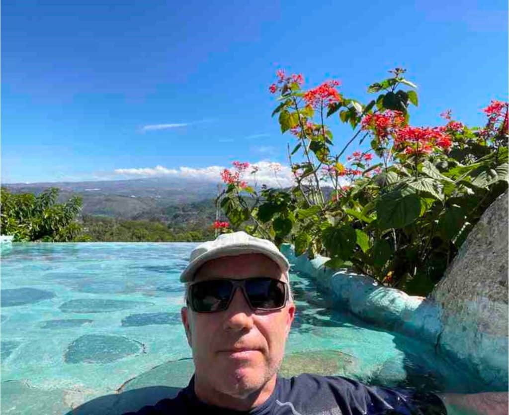
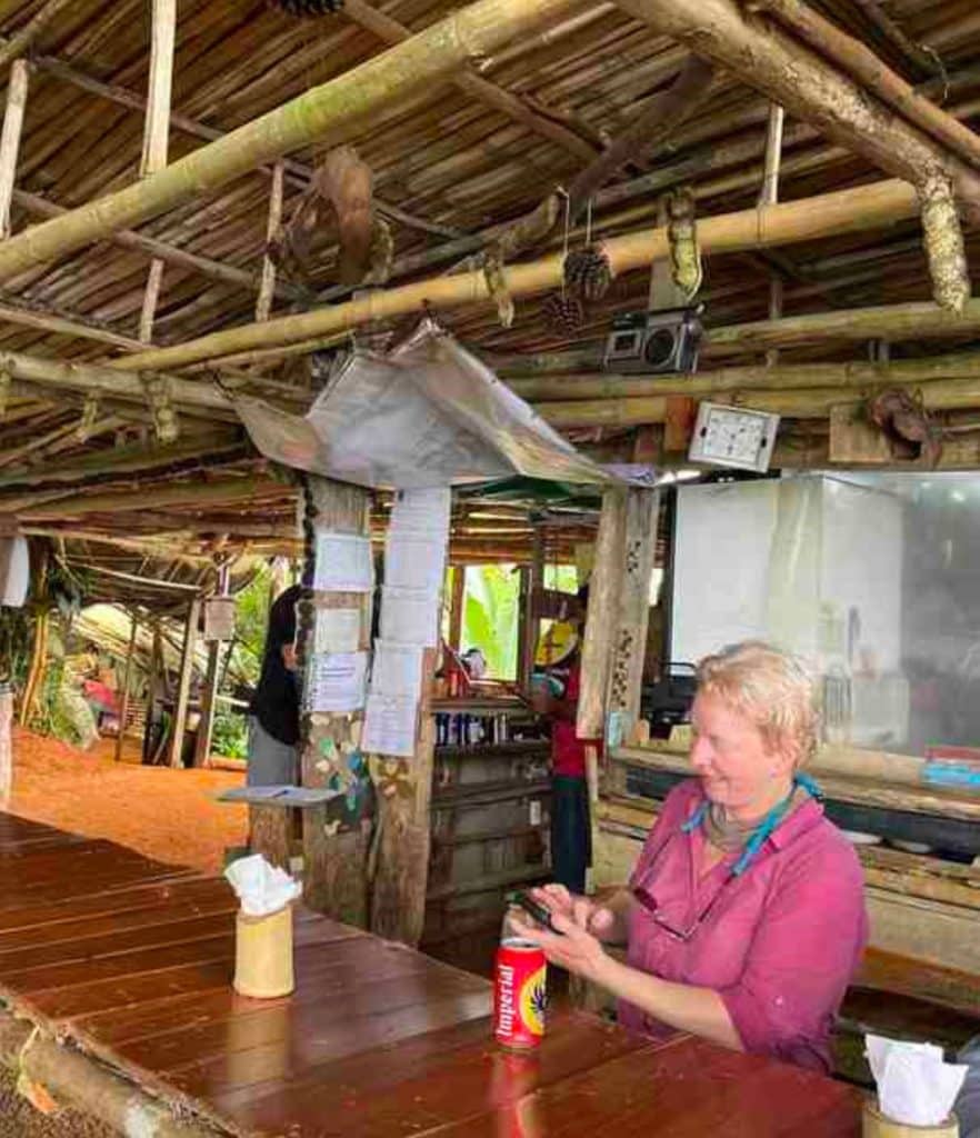
We went to the Hacienda Orosi Hot Springs and Farm today. It was a pleasant day, sitting in 100 F hot springs looking out over the Orosi Valley, rubbing ourselves with mud, napping and getting caught up on internet stuff. Lunch was a raspberry drink with rice and shrimp, fries and a dessert. The food overall on this trip has been excellent.
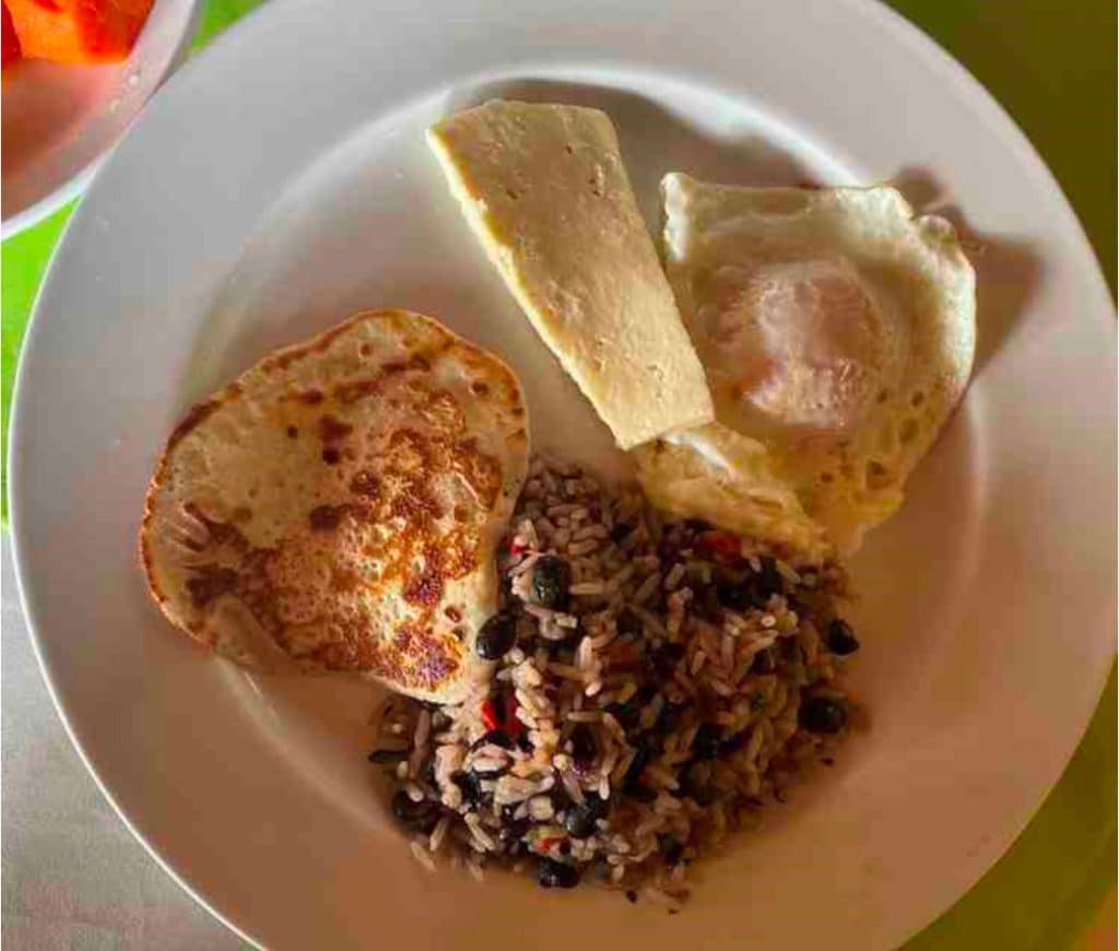
One of the benefits to walking distances is that you get to eat back those extra calories. When traveling, I try to only eat local foods. Costa Rican food, while simple and not spicy, has Afro-Caribbean, Mexican and South American influences with lots of fresh fruit and vegetables, rice and beans and (mostly) chicken and pork. A traditional breakfast would be rice and black beans (Gallo Pinto), a fried or scrambled egg, fried plantains, and palmito cheese (a fresh cheese that looks like tofu and has a mild mozzarella-like flavor). Bread was not common, at least on the Caribbean side of the Camino, until we moved into more touristed areas. The table always had a bottle of Salsa Lizano, a sort of blend of the British HP and Worcestershire sauces.
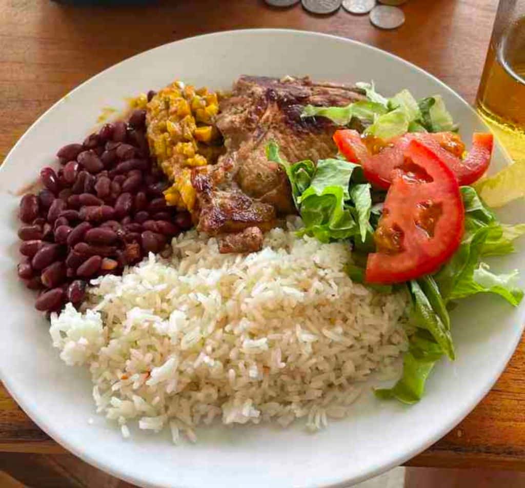
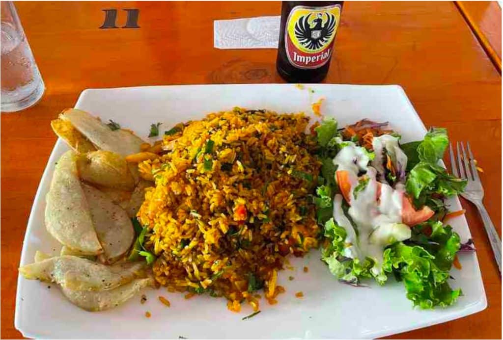

I tried to keep a list of all the fruit that we were served but I lost track. There is nothing like a fresh banana picked off the vine. In addition to the usual watermelons, pineapples, and mangos we had blackberry, breadfruit, guava, papaya, passion fruit, and sour orange to name a few – sometimes served as juice instead. Sit- down lunch and dinner were served “casado” style, meaning a plate with rice and beans, a salad, vegetables like palm hearts or yucca, some chicken or a pork chop and a drink. Our bag lunches typically were a tortilla wrapped in banana leaf.
Needless to say, no one in our group went hungry. Walking with 8 women, some of whom were light eaters, meant that I was fed a lot of extra food.
Day 10. Thursday April 21. Arriba, Abajo, al Centro, Pa’ Dentro
Distance = 18 km ( 10.8 miles)
Leaving Rio Macho, we walked uphill in the shade for a while, past aqueducts that transport water to the city of San Jose. Some really steep hills today with impossible looking grades of 20% slopes or more. These hills are perfect for coffee growing, and we walked through some coffee plantations for a bit, before joining the road that wound its way to the small community of Navarro Muneco where we ate lunch in a tiny cafe by a stream. We were taken back to Orosi and after we cleaned up, we all gathered for a social hour to swap stories, drink wine/beer and learn a new toast in Spanish. To toast “Arriba, Abajo, al Centro, Pa’ Dentro” you take your glass of beer lift it Up, drop it Down, bring it to the Center, and then drink it.
The rest of the gang went out for gourmet pizza, while I stayed home to talk to family.
At the start of the day, when we were all together, Juancho shared his font of knowledge about the flora and fauna, history, customs and people of Costa Rica. As the day went on, our group tended to get stretched out into small clusters. We had lots of time, so we had great one-on-one conversations on all sorts of topics: past and future adventure travel, modern cosmology and black holes, jalapeño wine, CrossFit and the correct form for squats and pushups, families and children, the housing market, how to correctly castrate a lamb, COVID, women and STEM, how best to donate to charity, picking the right toenail polish, and how two people who disagree can have a respectful discussion.
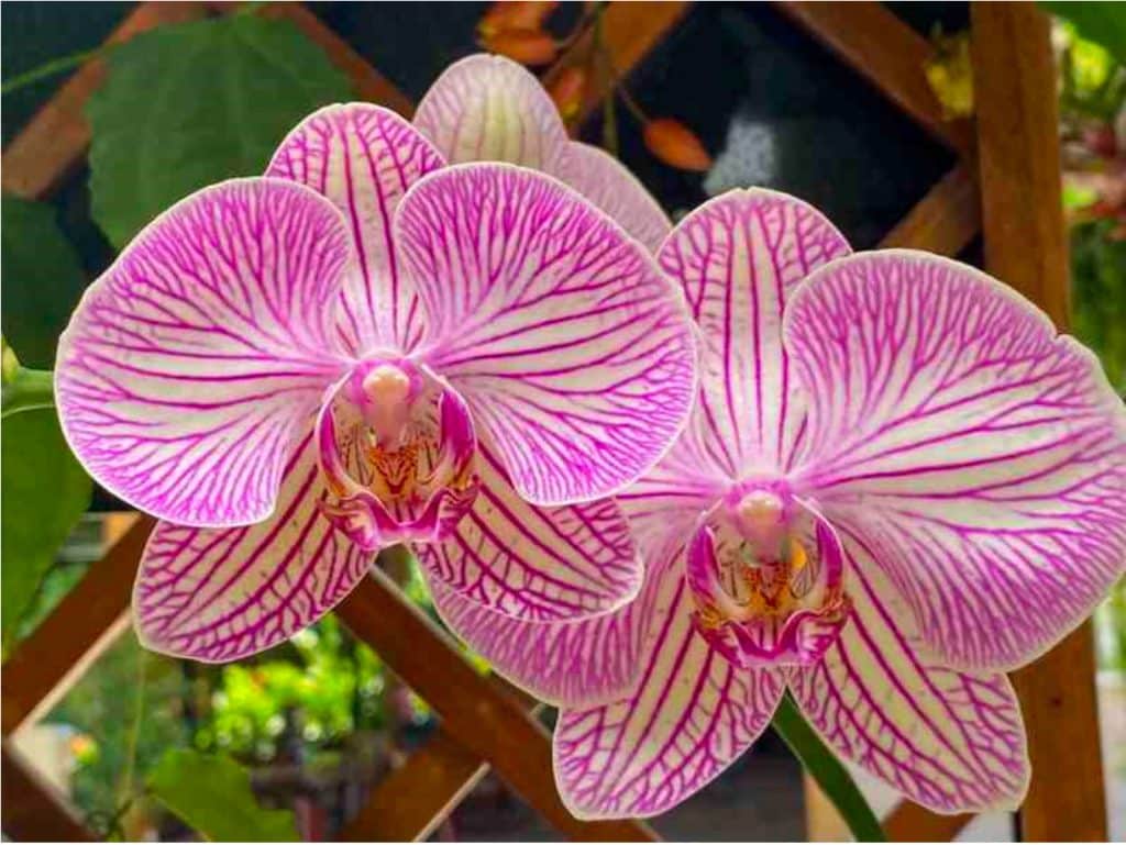
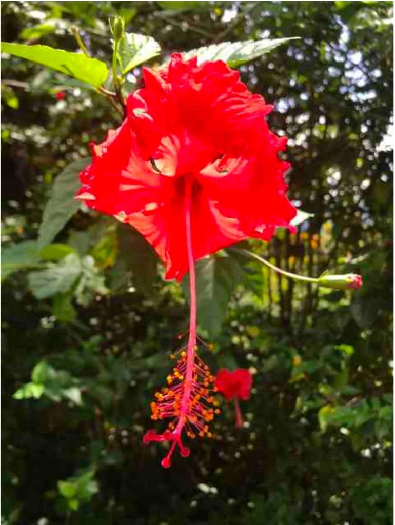
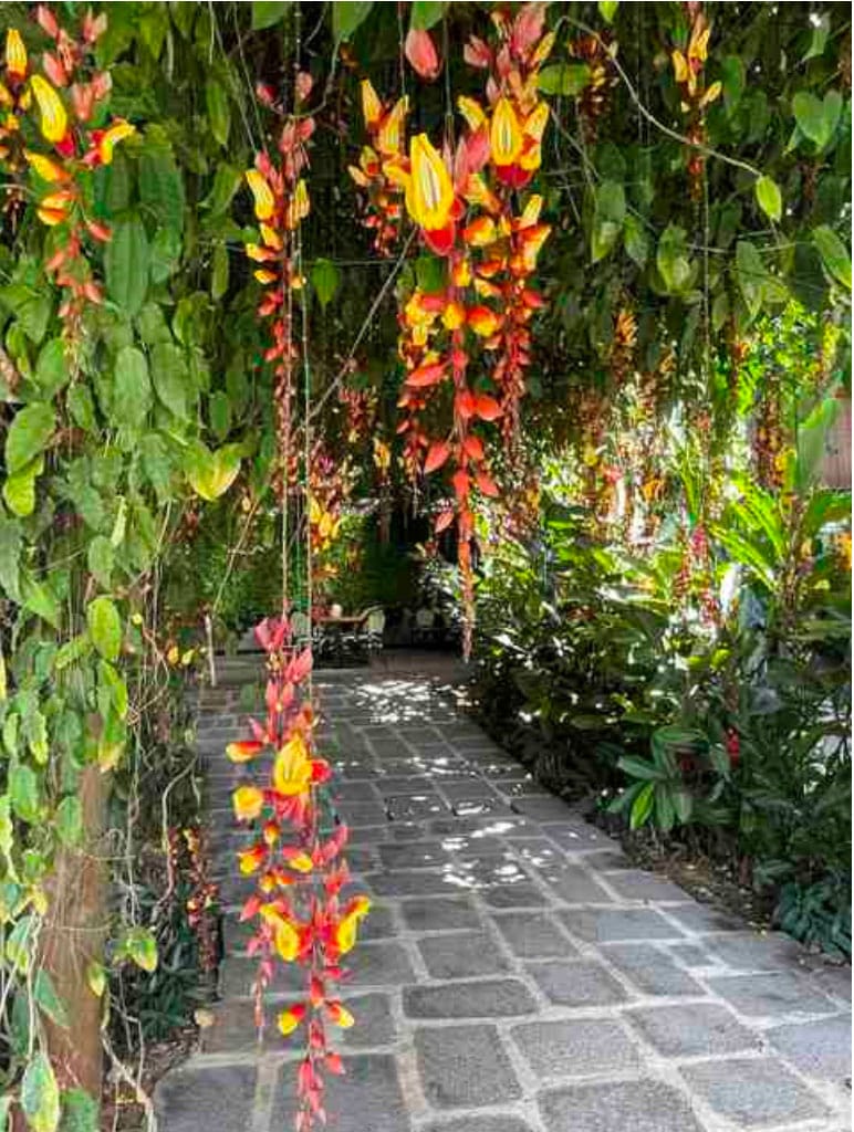
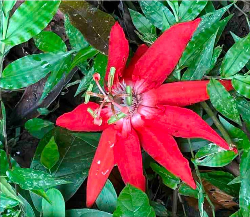
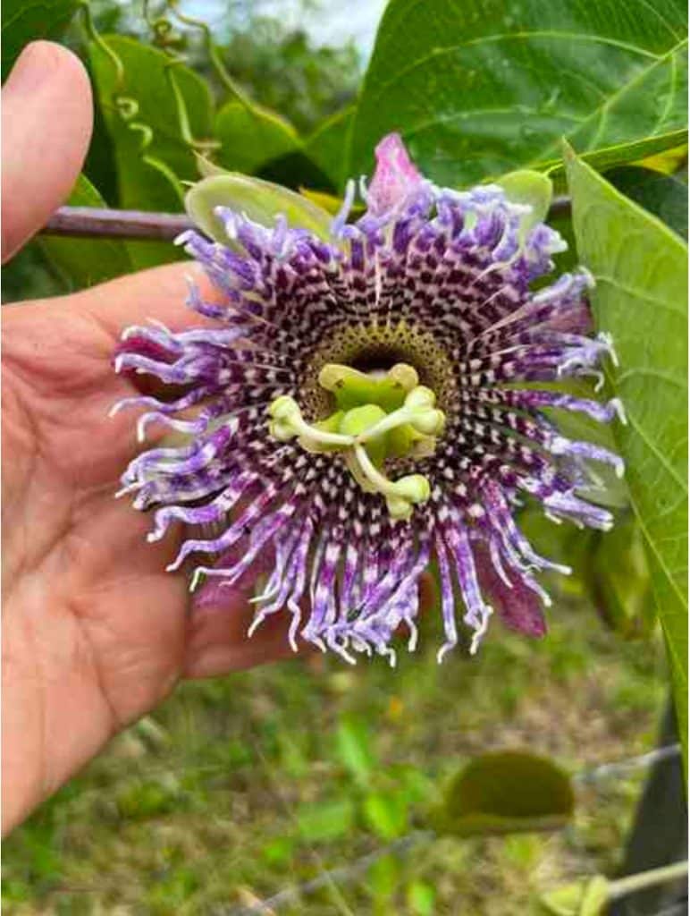
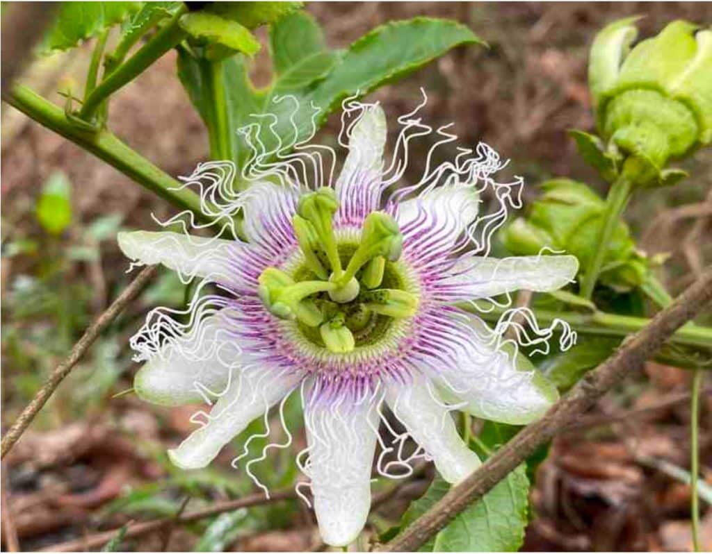
Have a few pictures of flowers taken by Juancho and me. Flowers grow everywhere in Costa Rica, wild and in people’s front yards.
Day 11. Friday April 22. An achein the hips (Navarro Muneco to Palo Verde)
Distance = 13km (7.8 miles)
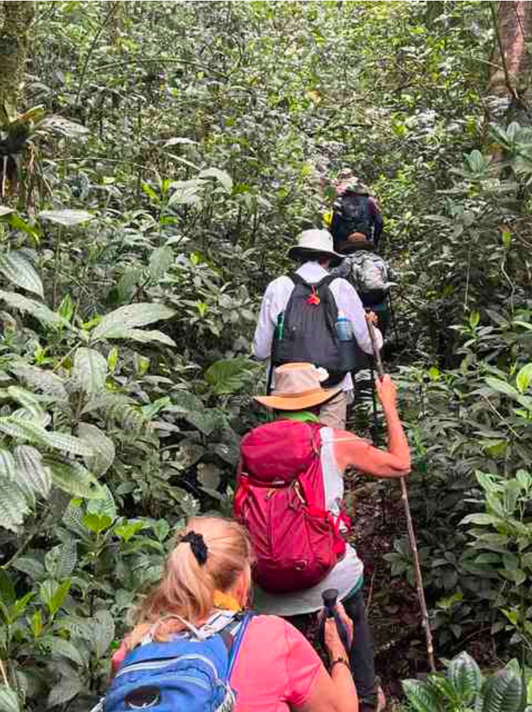
This day had a little bit of everything. We had a superb breakfast at Orosi Lodge. Travel and Leisure magazine had called it one of the best breakfasts in Costa Rica and I agree. After returning to the trailhead, we walked into a private reserve called the Palo Verde Cloud Forest. This narrow trail through deciduous forest at around 1750 m (5740 ft) overflows with plants and animals and was a joy to walk through. I think this may have been my favorite walk in the entire Camino as it captures wild Costa Rica better than anyplace else.
We’ve seen a lot of birds, insects and mammals on this trip – thanks in large part to our guides. All four species of Costa Rican monkeys (Squirrel, Howler, Spider and White-throated Capuchin), sloths, all varieties of birds, lizards, spiders, etc. Today we even saw the track of an ocelot or Yaguarundí. However, I don’t have many good photos. My camera was not up to the job, and on a long walk, the idea of carrying anything larger than an iPhone did not appeal. So instead, just close your eyes and imagine the sights and sounds of the jungle.
We arrived at Verdesana Forest Lodge and after a great lunch, we retreated to our cabins to clean up and rest. The clear and sunny good weather for the last several days, looks to have come to an end. I watched the downpour safely from my balcony. Before dinner we all did an hour-long yoga session. It was painful but at the end I could feel some of the stiffness in my muscles lessen, especially those tight hips.
Day 12. Saturday April 23. Dancing Queen (Palo Verde to Empalme)
Distance 16km (9.6 miles)
At breakfast we had two special visitors. Andres of UrriTrek and Conchita of Asociacion Mar a Mar. It was a real honor to meet and talk to two people so dedicated to promoting El Camino de Costa Rica. We sang happy birthday to one our hikers who turned 60 today.
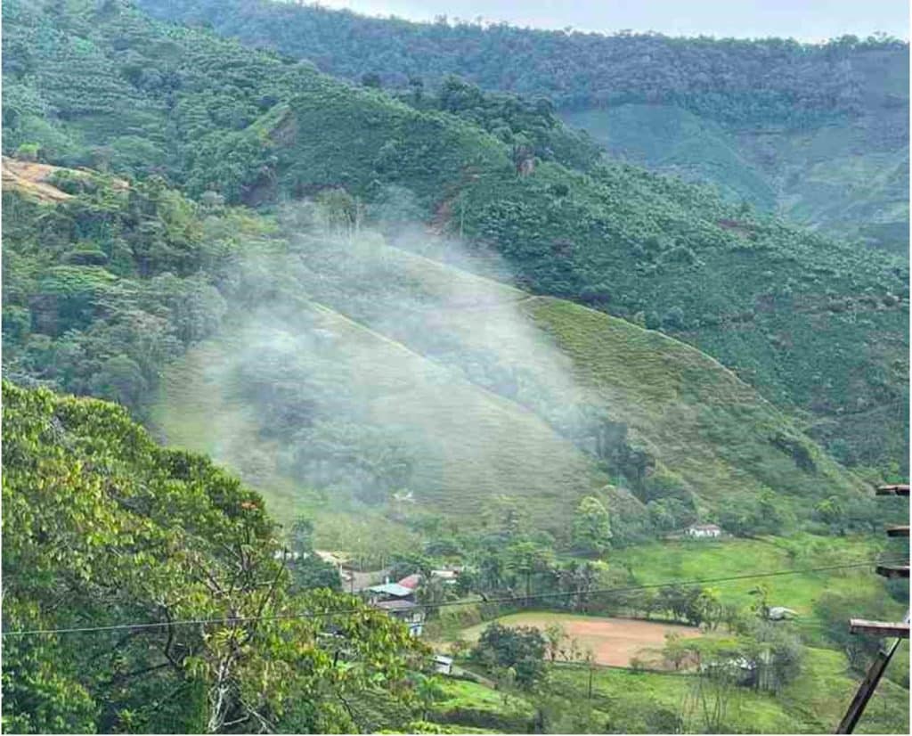
We climbed into the clouds today. Hills, hills and more hills. All shrouded in fog. We walked on mostly dirt roads through cultivated fields of coffee, raspberries and passion fruit. Near the top, we stopped at Mi Refugio, a farm that specializes in hydrangea flowers and eucalyptus leaves for the wedding market. They played Abba’s Dancing Queen as we walked through the greenhouse to our coffee and fruit snack. Let me just say that there are some impressive dancers in our group!
From there we walked to the Pan-American highway, where we had lunch at a coffee shop, and then walked downhill in the light rain along the busy road to Cabinas Turisticas Cerro Alto, where we spent the night. The meals were delivered directly to our cabins as the restaurant had recently burned down. Looking back at the cabins, perched on the hill, through the fog and light rain was kind of spooky. Adding to this Hitchcock-like atmosphere, a tiny bird with a crown of feathers on the top of its head kept throwing itself at my window trying to get in.
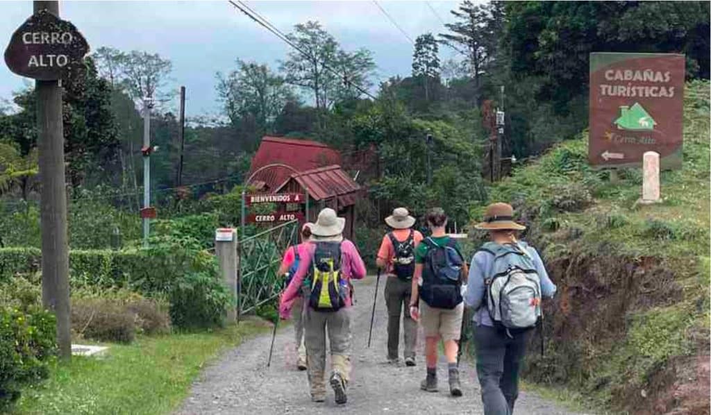
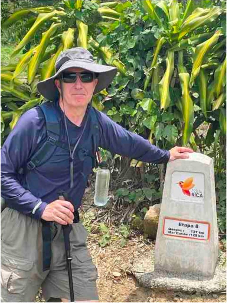
Day 13. Sunday April 24. The Gas Station at the Top of the World.
Distance=24km (144 miles)
We crossed the continental divide today – a gas station at 2035 m (6680 ft). From here it is all downhill to the Pacific! The first half of the day was road walking and there were lots of Sunday drivers out. Not fun. After a bit we found ourselves walking on dirt roads along a high ridge looking down into coffee plantations that descended into our first coniferous forest. Really lovely.
The people we meet in person or driving have been really nice. There are not that many hikers walking around these rural communities and so we are a bit of a curiosity. Many don’t seem to realize that the Camino exists. We talked to an expat American who had a Camino section marker outside the driveway to his house and he was not aware of what it was. People who recognize us as Camino hikers seem really happy to see us in their communities. They honk their horn, wave and say hello, or offer encouragement as they pass by us. The proprietors of the local restaurants all seem to want a group photo of us. It is nice to think that our walk may be having a positive impact on these rural communities.
Lunch was at a bar and restaurant outside of San Pablo where we had a few beers and delayed finishing as long as possible to avoid the rain. We trudged downhill in the rain to Hotel Palenque Tarrazu, where we dried off, cleaned up and played cards before dinner and an early bedtime.
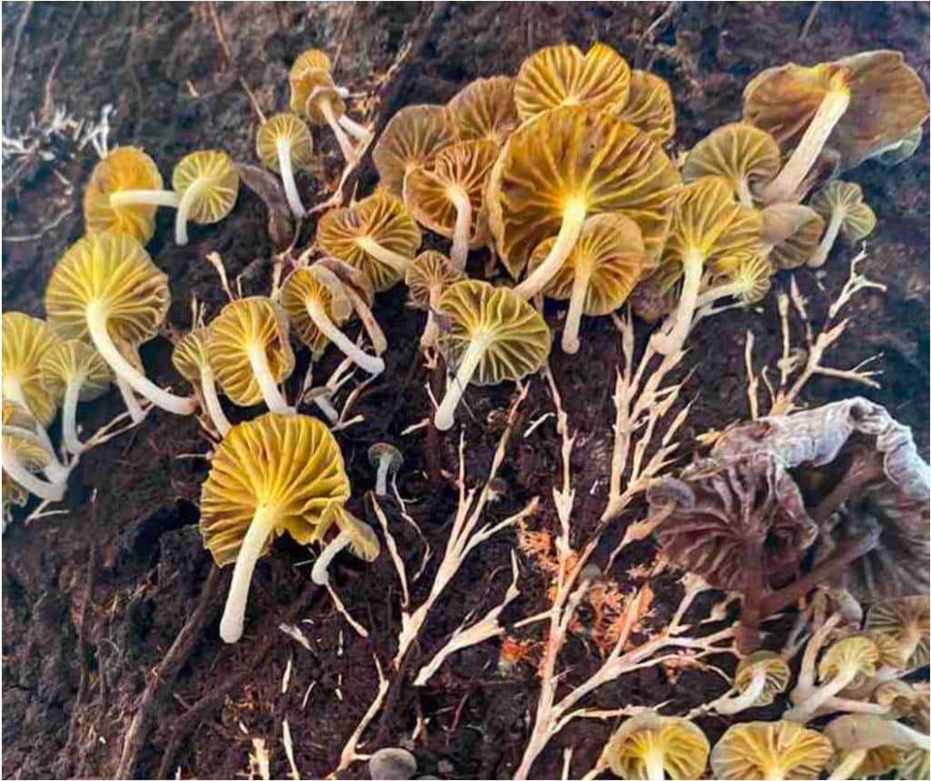
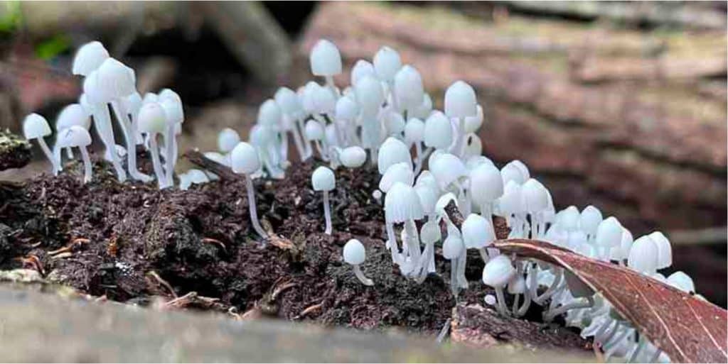
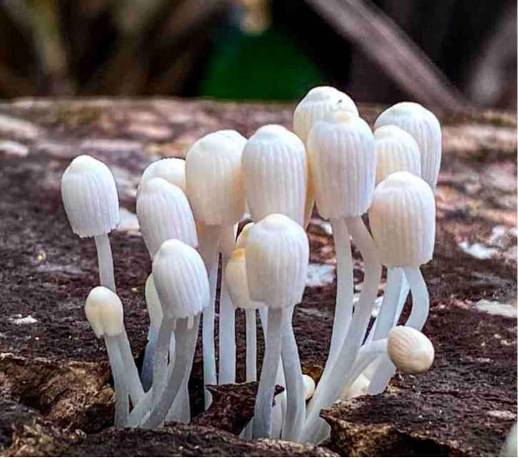
To mark the return of the rain, here are some photos of mushrooms and lichen. The best ones were taken by Juancho, the rest by me.
Day 14. Monday April 25. Uno Dos Tres… (San Pablo to La Esperanza)
Distance=16km (9.6 miles)
It was a long, hard day yesterday so some of the group elected to take today off. Juancho says this is his least favorite day: too many coffee plantations. I liked it. I’ve been drinking a lot of coffee on this trip. I’m no expert, but it is darn good coffee. Drinking coffee is not something I do at home, but I promised myself (and my friends John and Jan) that I would and so I am. I think we are walking today within the Los Santos Zone where some of the best coffee in Costa Rica is grown. Walking along the ridges looking down and through the fields, you get a sense of how important coffee must be for the local economy. The coffee is picked by immigrant labor.
Low pay and harsh conditions. Families from Nicaragua live adjacent to the fields in small huts housing 15-20 people.
Before lunch we had a brutal uphill to the small town of La Esperanza. A bit further on, and without warning, Juancho turned and started walking along a narrow path into the jungle. We followed him up a hill through gorgeous scenery for about 10 minutes where we arrived at Finca Lirios, a family-run eco lodge set up for hikers. I could never discover this place on my own in 100 years. We had a great lunch and a good rest before trudging to our pickup spot in hard rain.
The others were waiting for us back at the hotel with beer and wine. I had more than usual, ostensibly to prepare for the dance lessons that evening. It didn’t help. My feet didn’t want to keep beat for the salsa. Uno Dos Tres…Cinco Seis Siete. What about Cuatro? Why is there no Cuatro? I was marginally better at the Scottish dance, thanks only to my partner. Oh well. Stay open to new things and try again.
Day 15. Tuesday April 26th. Black holes ( Esperanza to Naranjillo)
Distance = 19km (11.4 miles)
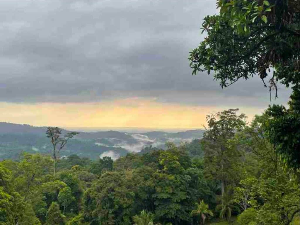
While driving to the trailhead, I gave everyone a short lecture on black holes…because, why not? Lots of downhill walking today as we take winding dirt roads and start to leave the coffee plantations. We got our first view of the Pacific Ocean this morning!
For lunch we stopped in at Rancho Turistico Mirador Buena Vista Tarrazú, a nearly inaccessible no-frills restaurant that serves great food and has a tree house-like view of the town of Quepos and Manuel Antonio National Park. Imagine that you are walking in France in the middle of nowhere and you come across a one-star Michelin restaurant. That is what it felt like.
After lunch we took a detour along a narrow jungle path back to the road that took us down into the small town of Naranjillo. This small community runs a sheltered tent area where the women of the village cook meals on a wood stove for tired hikers. I had to pinch myself. I felt really privileged to be taken in and looked after by these people. There was no internet so we had our cold showers, washed some clothes, played cards and drank wine and agua dulce until dinner. Sleep comes with the now familiar sound of rain tapping rhythmically on a tin roof.
Day 16. Wednesday April 27. Naranjillo to Esquipulas
Distance = 16km (9.6 miles)
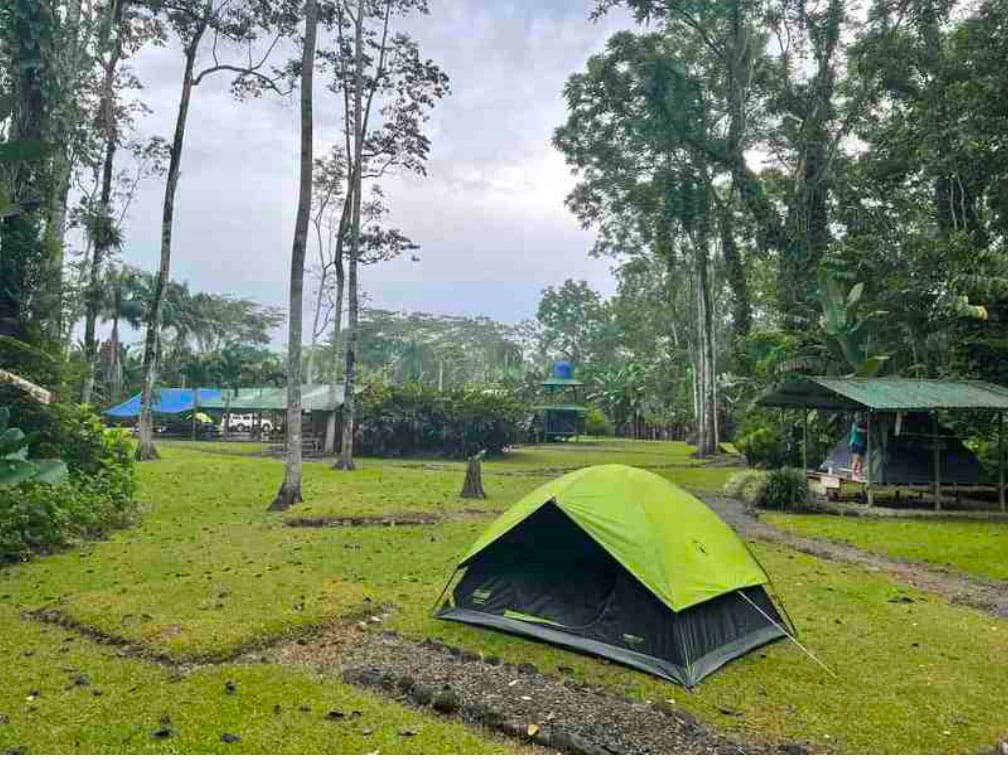
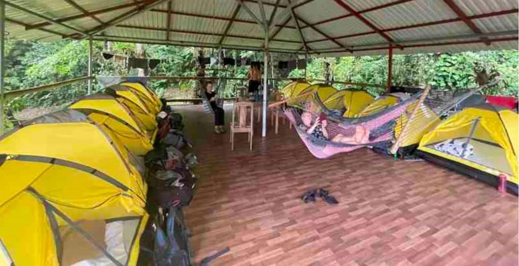
Nothing dries overnight in this climate, so I put on my wet clothes and started walking. We made it to the Esquipulas Rainforest where we selected our tents, cleaned up and washed some clothes. We shared the place with a group from the World Bank, who are section hiking the Camino. Birding is popular, and we saw many yellow and black macaws while sitting in the dining area. Several of us walked over to the nearby Naranjillo waterfall.
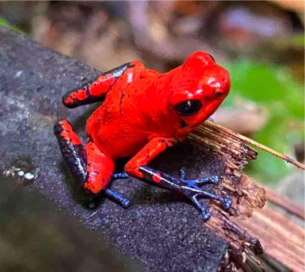
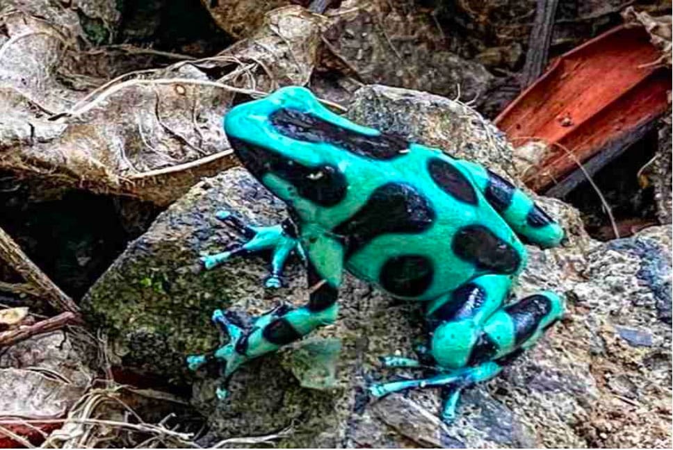
After dinner, when it had gotten dark, we all put on our headlamps and went froggin’. We’ve been seeing and hearing frogs all through Costa Rica but this was something else. Here is a collection of frog photos taken that night and other days by Juancho’s superior camera. Among others there is a Blue Jean dart frog, a poisonous Black and Green Dart frog and some Red-Eyed frogs (with their eyes closed).
Day 17 Thursday April 28. Finding Your Tribe
Distance = 30km (18 miles)
I didn’t learn my lesson and so I had to put on wet clothes again. It was a long day, but after a walk in our last Costa Rican jungle, the rest of the day was along the marshy flatland that follows the Naranjo River. We had to cross the river in a few places but we are old hands at that now. The rest of the afternoon was a long walk- through miles and miles of date palm plantations with their symmetric rows.
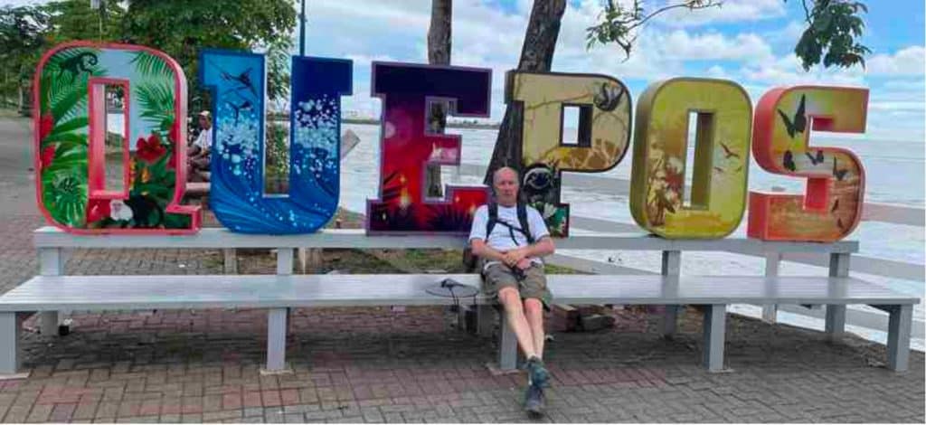
Toward the end of the plantations, we all put on a UrriTrek T-shirt commemorating the completion of the Camino de Costa Rica and we walked out onto the road into Quepos. Right away, from the traffic and signs in English, you could tell that you were in a tourist area. We said goodbye to Geovanni, and walked the final few km into Quepos where we did the obligatory photo in front of the town sign and ate lunch. After lunch we signed the Camino register for official walkers who complete the walk. We are all feeling pretty good. Got a ride to a fancy tourist hotel with hot water and air conditioning!
The farewell dinner was at El Avion restaurant whose bar is made from the fuselage of the downed plane that ignited the Iran-Contra affair in the 80’s. At dinner I said a few heartfelt words to everyone in our walking group. For privacy reasons, you will not have seen any closeups of anyone else in our hiking group unless they are already in the public domain via podcasts or a tour company. Angie, Brenda, Debra, Kevin, Kit, Patricia, Peggy, Sharron, Sue, and Tony, and our guides Geovanni and Juancho. I am going to miss everyone. Thank you for letting me come on this grand adventure with you.
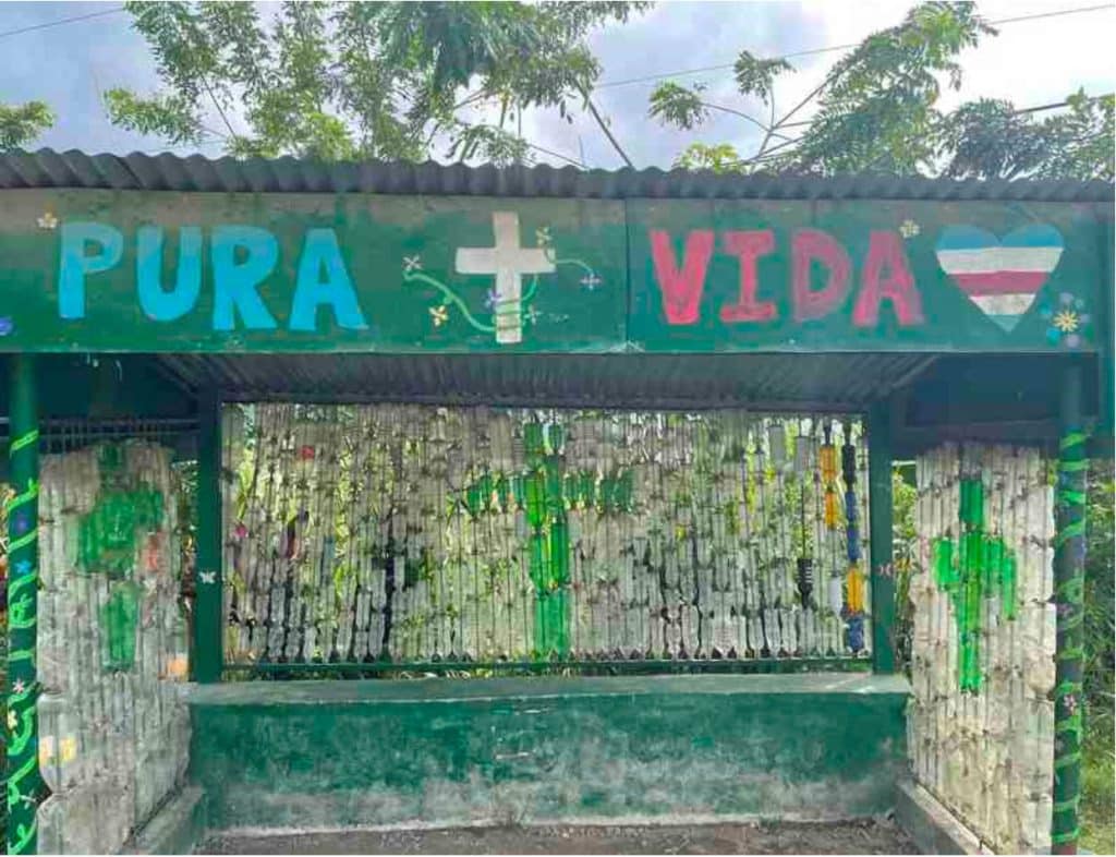
¡Pura Vida!
Leave a Reply